How to Calculate Cut and Fill
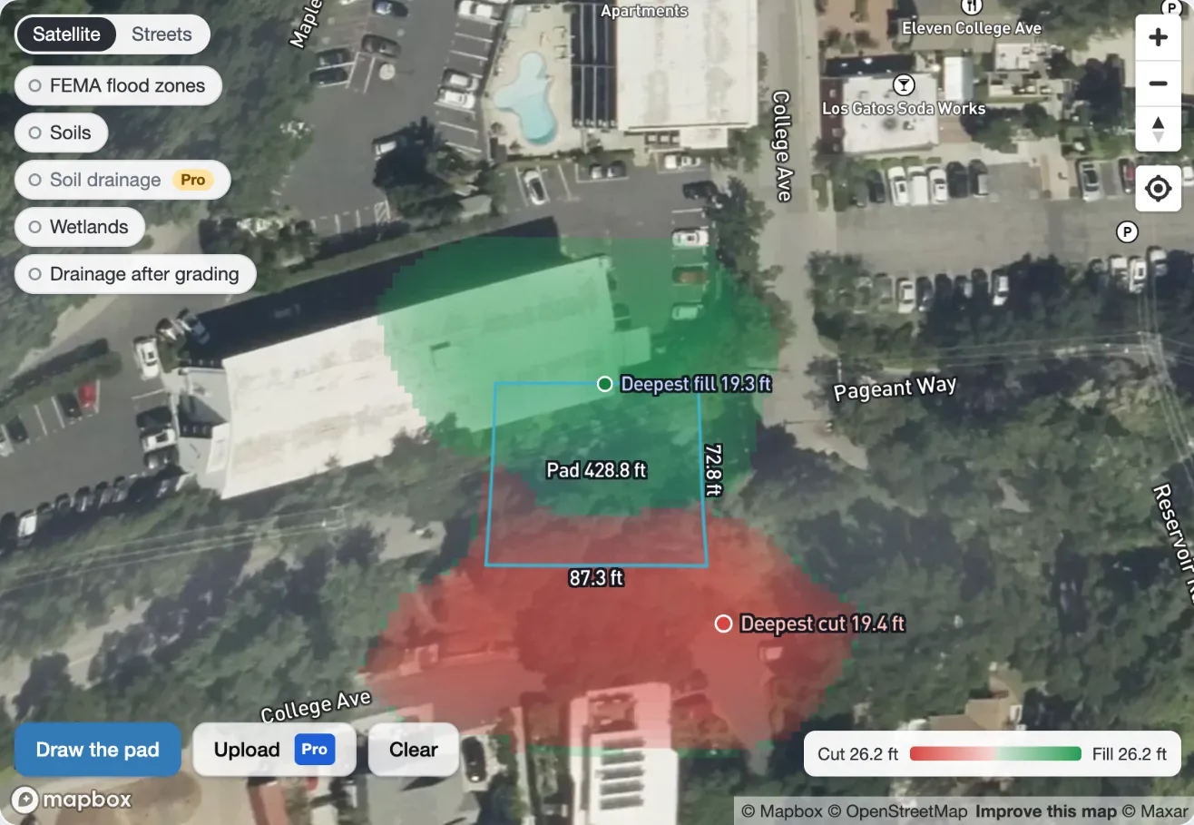
A building pad is a flat area graded at one elevation. Where the ground is above the pad it has to be dug out, which is cut. Where the ground is below the pad, soil has to be brought in and compacted, which is fill. Cut and fill volumes set what the grading costs: how much soil is moved on the site, and how much is hauled in or out by truck.
This tutorial works through the grid method, which is how most estimating software and our calculator do it. It covers topsoil stripping, side slopes, shrink and swell, the pad elevation where cut and fill balance, and truckloads, with a worked example you can check by hand.
Three kinds of volume
The same soil takes up a different volume depending on where it is, so every earthwork number needs to say which one it means:
- Bank volume is soil in the ground before it's dug. Cut is measured this way.
- Loose volume is the same soil dug up and in a truck. It's larger, because digging opens up the soil. The increase is the swell.
- Compacted volume is soil placed as fill and compacted. It's usually smaller than the bank volume it came from. The loss is the shrink.
| Soil | Swell | Shrink |
|---|---|---|
| Sand and gravel | 12% | 8% |
| Common earth, loam | 25% | 10% |
| Clay | 35% | 15% |
| Rock | 60% | not used as fill |
Typical values. A geotechnical report or the grading contractor's experience with the local soil beats any table.
The grid method
Lay a grid of squares over the pad. For each square:
- Find the existing ground elevation at the center of the square.
- Take off the topsoil, which is stripped and stockpiled before grading. It isn't structural fill.
- Subtract the pad elevation. A positive depth is cut and a negative one is fill.
- Multiply the depth by the area of the square.
Then add up the cut squares and the fill squares separately:
Vcut = A × Σ dcut Vfill = A × Σ dfill
where A is the area of one square and d is each square's depth. Smaller squares follow the ground more closely. A survey crew might shoot a 25 or 50 ft grid. The calculator uses lidar with a point every meter (about 3.3 ft).
Worked example
A 90 ft by 60 ft pad at elevation 101.0 ft on ground that falls about 5 ft from northwest to southeast. Use a 30 ft grid, so six squares of 900 sq ft each, and strip 6 in (0.5 ft) of topsoil.
Add up each side and multiply by the 900 sq ft area of a square. There are 27 cubic feet in a cubic yard:
| Cut | (2.5 + 0.5 + 1.5) × 900 = 4,050 cu ft | 150 cy |
| Fill | (1.0 + 1.0 + 2.5) × 900 = 4,050 cu ft | 150 cy |
| Topsoil stripped | 6 × 0.5 × 900 = 2,700 cu ft | 100 cy |
Of the 150 cy of fill, 50 cy (0.5 ft in each of the three fill squares) only brings the stripped ground back up to where it was. That fill is there because of the stripping, not the slope.
Cut and fill are both 150 cy, but they don't balance. Bank cut shrinks when it's compacted. With 10% shrink, the 150 cy of cut makes 150 × 0.9 = 135 cy of compacted fill, which is 15 cy short. Making up the 15 cy takes 15 / 0.9 = 16.7 cy of bank soil from somewhere else.
Truckloads
Trucks carry loose soil. With 25% swell, the 16.7 cy of import is 16.7 × 1.25 = 20.8 cy loose. A tandem dump truck carries about 12 cy, so that's 2 loads. Triaxle dumps carry about 15 cy and semi end dumps about 20 cy.
Topsoil is usually stockpiled on site and spread again over lawns and planting at the end. Hauled away, the 100 cy is 125 cy loose, or 11 loads.
The balance elevation
Moving soil around the site is much cheaper than hauling it in or away. The pad elevation where the cut, once compacted, exactly makes the fill is the balance elevation:
Vcut × (1 − shrink) = Vfill
Lowering the pad adds cut and takes away fill, so there's one elevation that does it. In the example, between 100.0 and 101.5 ft the three cut squares give 900 × (307.5 − 3P) cu ft and the three fill squares give 900 × (3P − 298.5) cu ft, for a pad elevation P. Setting 0.9 times the first equal to the second gives P = 100.92 ft. Lowering the pad by about an inch makes the site balance with no trucks.
In practice the pad elevation also has to drain, meet the street and stay above the flood elevation, so the balance elevation is a starting point rather than the answer.
Side slopes and the daylight line
A pad needs slopes at its edges unless there's a retaining wall. A cut slope rises from the pad's edge until it meets the ground. A fill slope falls from the pad's edge until it meets the ground. Where each slope meets the existing ground is the daylight line. Slopes are given as horizontal to vertical: a 2:1 slope runs 2 ft out for every 1 ft up. Fill slopes are usually flatter than cut slopes, because placed fill is weaker than soil that has never been dug. 2:1 for cut and 3:1 for fill are common, but the soil report and the local grading code decide.
The slopes can add a lot. On steep ground the cut and fill under the slopes can be as large as under the pad itself, and the disturbed area, which sets the topsoil strip and often the permits, is much larger than the pad. By hand, extend the grid past the pad and give each square outside it the slope's elevation at that distance from the edge:
cut slope: P + d / scut fill slope: P − d / sfill
where d is the square's distance from the pad's edge and s is the slope (2 for 2:1). Ground above the cut slope is cut down to it, ground below the fill slope is filled up to it, and ground between the two is left alone.
The average end area method
For long, narrow work like roads, trenches and channels, estimators often use cross sections instead of a grid. Draw a section every 25, 50 or 100 ft, measure the cut and fill areas in each, and take the volume between two sections as their average area times the distance between them:
V = (A1 + A2) / 2 × L
Two sections 100 ft apart with 240 and 360 sq ft of cut give (240 + 360) / 2 × 100 = 30,000 cu ft, or 1,111 cy. For a building pad the grid method is simpler, because the cut and fill change in both directions.
Cut and fill from lidar
The cut and fill calculator does the grid method on the ground itself. It reads the USGS 3D Elevation Program's lidar under the pad: bare earth, with buildings and trees taken out, one point per square meter. A survey grid has a point every 25 or 50 ft.
- Find the site on the map and click the pad's corners. Pro accounts can also upload the outline from a CAD drawing (DXF) or a spreadsheet of corner coordinates.
- Set the pad elevation, the cut and fill slopes and the topsoil depth. It works out the daylight line all around and shows the cut and fill on the map as you drag the pad elevation.
- Balance finds the balance elevation, with the shrink for the soil you choose.
- It gives the cut, the fill, the import or export as bank and loose volume, the truckloads and the topsoil.
- A 3D model of the site shows the pad, the slopes and the ground they replace, with contours and dimensions.
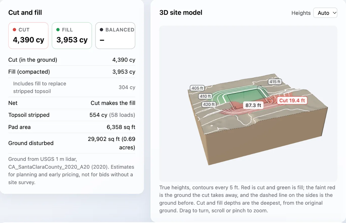
Lidar is an estimate, not a survey. The USGS lidar used here is generally accurate to about 10 cm (4 in) vertically on open ground, but it's only as recent as the flight, which can be several years old. Grading done since then isn't in it. Use it for planning, pricing and comparing pad elevations, and get a site survey before bidding the work.
Frequently asked questions
What's the difference between cut and fill?
Cut is soil dug out where the ground is above the finished grade. Fill is soil placed and compacted where the ground is below it.
How many cubic feet are in a cubic yard?
27. Divide cubic feet by 27 to get cubic yards.
Why doesn't the same volume of cut make the same volume of fill?
Compaction squeezes soil into less space than it took up in the ground, by about 10% for common earth. So 100 cy of cut makes about 90 cy of fill. Rock goes the other way and usually isn't used as fill.
Should topsoil count as cut?
No. Topsoil is too soft and full of organic matter to build on, so it's stripped first and counted on its own. Cut and fill are then measured from the stripped ground. Where the pad is in fill, that means a little more fill.
What grid spacing should I use?
Small enough that the ground is close to a plane inside each square. 25 ft is common for a building pad on rolling ground, and 50 ft on gentle ground. Halve the spacing and compare: if the totals barely change, the grid is fine enough.